Miguel Cervantes
Jedi Master
With things starting to heat up in the Tropics it looks like we will get to feel the effect of some of that weather, even if it is just rain.
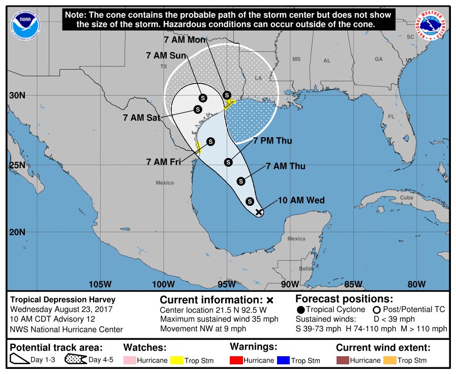
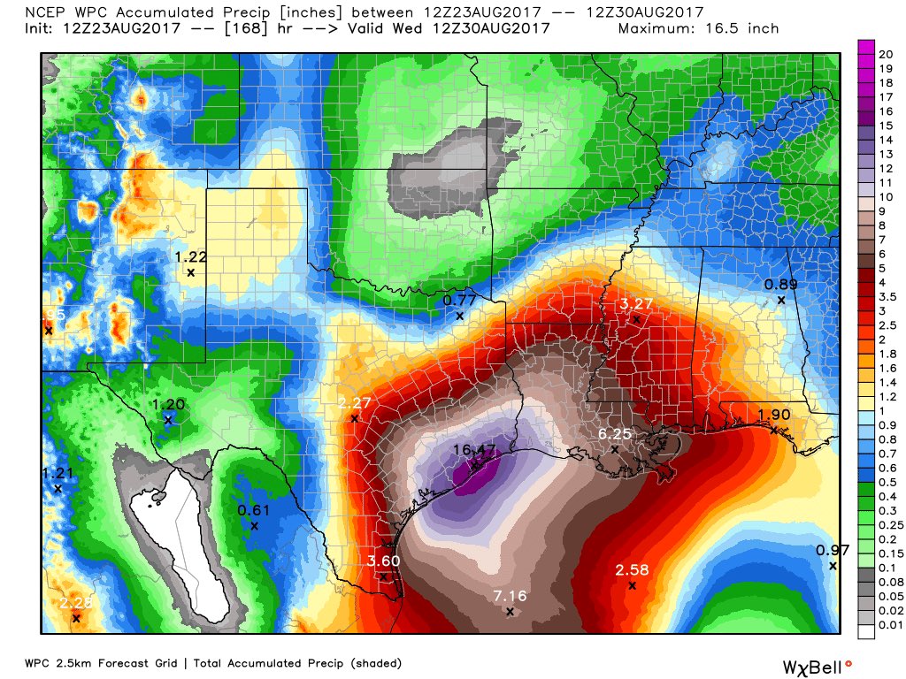
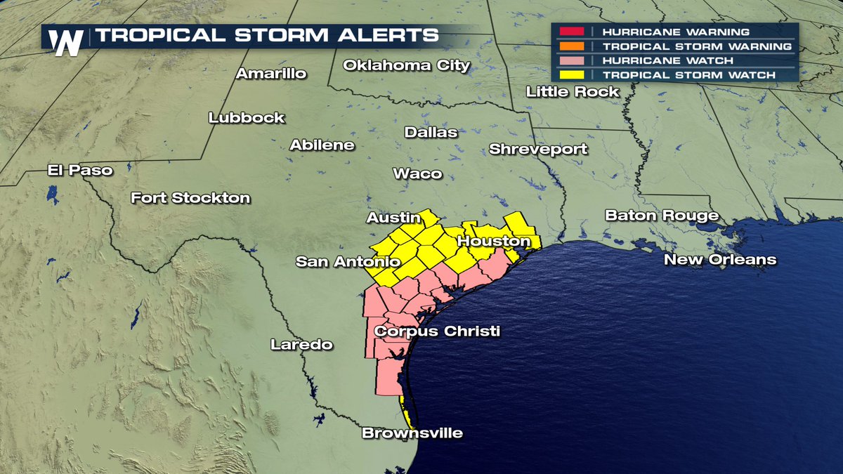
Harvey is expected to come in to the US as the first landfalling hurricane this year. With the lack of a steering current in the upper atmosphere it could dump tons and tons of rain over the areas it travels.
I certainly hope New Orleans gets their pump problems solved prior to early next week. If Harvey drifts over the SE at a slow pace it could be devastating in the way of flooding for many locations.
The GFS and CFS are on two totally different solutions for the path and timing. The NAM only reaches out to 84 hours or so, so it doesn't have an opinion yet.
If the GFS proves out, we could see Tuesday or Wednesday highs in the 60's with a lot of rain.
Here's the NAM map showing a double whammy for the US, one landfall storm and one just brushing the SE / Atlantic coastline.