map creation software success....

CaptainSolo

Senior Member
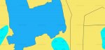
I just updated some of my Navionics cards and found a map that I made with SonarCharts Live in a single day of a small lake near me. Ive been able to go out and check the accuracy and it is pretty spot on, and Ive caught a bunch of fish using the map since the update.

So, I want to see your screen shots of your best maps you created from your own sonar logging!

Is there any lakes in your area that you know have been updated with better detail?
 

Attachments

  • download.jpg
    download.jpg
    22.1 KB · Views: 206
  • download (20).jpg
    download (20).jpg
    68 KB · Views: 207

scottpriest

Senior Member
that's great! I haven't had the opportunity to use this yet on mine. I want to do Heath lake on Rocky Mountain PFA, and a couple small lakes I fish. very cool!
How did you map it? pretty much just back and forth across the lake until you had the entire thing covered?
 

CaptainSolo

Senior Member
that's great! I haven't had the opportunity to use this yet on mine. I want to do Heath lake on Rocky Mountain PFA, and a couple small lakes I fish. very cool!
How did you map it? pretty much just back and forth across the lake until you had the entire thing covered?

Its actually easier than that. For the most part I just did it while I was fishing out of my kayak. The best part is that you can keep adding to the detail every time you go out so it just keeps getting better.

They recommend a figure-8 pattern as well as just a zig zag pattern for specific structure youre interested in mapping.

https://www.youtube.com/watch?v=AIRw6AWkkcI
 
Top