***General Discussion Weather Thread #9 2017***

Status
Not open for further replies.

Milkman

Deer Farmer Moderator
Staff member
I have to apologize, I stated it was the CMC. It is actually the CFS. Word of caution to deniers of the CFS, it actually has performed well this winter thus far, for a long range model. The other models have come into alignment with it closer to the time of events.

Ain’t winter yet::ke:
 

RinggoldGa

Senior Member
00Z GFS looks promising.

Waiting on the smart people to comment.
snod.conus.png
 

PappyHoel

Senior Member
Oh yeah! White Christmas for sure!

Don't say that, I have to have all relatives gone the day after Christmas. I don't want delays :). Love em but 4 days is too much.
 

smokey30725

Senior Member
Smart man.

My capabilities start and end with being able to link the map.

There is no analytical insight to be offered!

Come on down DDD, Miggy, malak

Come forth, GON Weather Trinity, and prognosticate to the masses!
 

Miguel Cervantes

Jedi Master
I ain't got no smarts, but this feller does.

<blockquote class="twitter-tweet" data-lang="en"><p lang="en" dir="ltr">The 288-hour forecast is now valid for Christmas morning! <br>Probability or chances of a White Christmas are actually increasing across the Plains -- but a lot more needs to change to get > 50% chance. This map is forecast prob (%) of at least an inch on the ground. pic.twitter.com/awOJLUwwtL</p>— Ryan Maue | weather.us (@RyanMaue) December 13, 2017</blockquote>
<script async src="https://platform.twitter.com/widgets.js" charset="utf-8"></script>
 

malak05

Senior Member
GFS has been bouncing around some winter solutions past few days runs in the Dec. 23r thru 25th range, EURO not so impressed still not inside 7 days so not much to dive into at moment we shall see how it goes

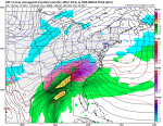
BUT... GFS 18z run today I'm sharing for pure entertainment cause it's nothing but hearsay this far out but boy it would be mother of all ice storms i guess is you wanted a 1800s christmas this would be for you... you know no power etc
 

Attachments

  • gfs_mslp_pcpn_frzn_eus_44.png
    gfs_mslp_pcpn_frzn_eus_44.png
    452.5 KB · Views: 674

Miguel Cervantes

Jedi Master
GFS has been bouncing around some winter solutions past few days runs in the Dec. 23r thru 25th range, EURO not so impressed still not inside 7 days so not much to dive into at moment we shall see how it goes

BUT... GFS 18z run today I'm sharing for pure entertainment cause it's nothing but hearsay this far out but boy it would be mother of all ice storms i guess is you wanted a 1800s christmas this would be for you... you know no power etc

The GFS is the pachinko ball of the meteorology world. :bounce:
 

deerhuntingdawg

Senior Member
GFS has been bouncing around some winter solutions past few days runs in the Dec. 23r thru 25th range, EURO not so impressed still not inside 7 days so not much to dive into at moment we shall see how it goes

BUT... GFS 18z run today I'm sharing for pure entertainment cause it's nothing but hearsay this far out but boy it would be mother of all ice storms i guess is you wanted a 1800s christmas this would be for you... you know no power etc

Nope, throw that solution in the trash. I don’t like it at all lol
 

DDD

Winter Weatherman
Christmas time talk is starting to hop on Twitter. The GFS is advertising some interesting runs. Also, long range models showing dumps of cold air piling South Eastward despite the NWS saying we are to warm up.

The SE Ridge that was modeled to be so strong during the next two weeks has been shoved really far south. The snow we had last weekend and the SE warm ridge not coming back as far north as first thought has things cooler and will allow more air to drop NE.

Also of note, there is blocking that is forcing the cold south that was originally thought not to be available.

What does all this mean? If the cold hangs around like I am beginning to think it will and low pressure systems are tapping gulf moisture... well... it could get interesting sometime during that time frame.

I don't get lost in the details of long range models. Moisture, depth of cold... all those things will change 1000 times between now and then. What I do pay attention to is if the GFS, EURO, CFS, JMA start advertising cold and possible storminess.

Right now, some of them are advertising just that, some are not as impressive.
 

mark-7mag

Useless Billy Director of transpotation
Well here we go. I don’t need to miss anymore work because of the weather this month
 

DDD

Winter Weatherman
Looking even closer there is a threat a week from Friday before we even think about Christmas snow.

The pattern looks stormy and cold going forward. I would suggest Fire Wood, alternative light and heat sources. Start thinking about it now. I am not saying its going to happen, what I am saying is when everyone else realizes its going to happen, preparing is too late.
 
Status
Not open for further replies.
Top