Nothin but Fish
Senior Member
A shout out to Robert Eidson for the heads up on some "fishy" action on the west side of town...
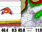
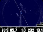
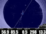
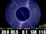
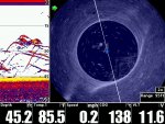
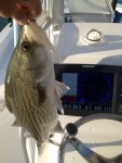
I got up at "odark thirty" this am and ran over to Toona to check it out and see what I could see on 360. Right off the bat I see some schooling fish and I do mean "see"....360 that is...you see it below") I boated a couple of "green fish" before moving on to where some other GON brothers were bendin their rods. Well after 30 minutes or so of watchin I was determined to see if I could get some stink in the boat with a good ol Captain Mack 3/8 oz jig tipped with a small white swim bait...
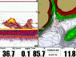
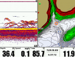
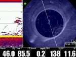
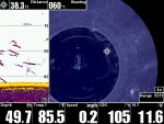
I boated a couple of "green fish" before moving on to where some other GON brothers were bendin their rods. Well after 30 minutes or so of watchin I was determined to see if I could get some stink in the boat with a good ol Captain Mack 3/8 oz jig tipped with a small white swim bait...

You tell me can you see what was happenin....

http://www.youtube.com/watch?v=m7vBmT3BNgo&feature=g-upl
I got up at "odark thirty" this am and ran over to Toona to check it out and see what I could see on 360. Right off the bat I see some schooling fish and I do mean "see"....360 that is...you see it below
I boated a couple of "green fish" before moving on to where some other GON brothers were bendin their rods. Well after 30 minutes or so of watchin I was determined to see if I could get some stink in the boat with a good ol Captain Mack 3/8 oz jig tipped with a small white swim bait...You tell me can you see what was happenin....
http://www.youtube.com/watch?v=m7vBmT3BNgo&feature=g-upl
Attachments
-
 S00200.jpg70.2 KB · Views: 6,024
 -
 S00201.jpg89.6 KB · Views: 4,998
 -
 S00208.jpg109.6 KB · Views: 5,261
 -
 S00213.jpg167.2 KB · Views: 6,227
 -
 S00216.jpg181.1 KB · Views: 4,585
 -
 S00227.jpg140 KB · Views: 4,647
 -
 S00216-001.jpg181.1 KB · Views: 4,433
 -
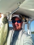 photo-001.JPG140.3 KB · Views: 2,165
 -
 mackjig-001.JPG105.1 KB · Views: 2,204