Back End of Winter 2015 / 2016

DDD

Winter Weatherman
Oh man... my own playground. :bounce:

Towards the end of the Winter Weather thread everyone wanted to know if winter was over? I will attempt to answer that tonight or tomorrow, but the knee jerk answer is no it's not.

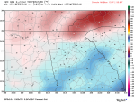
I saw some long term models yesterday that had the beginning of March very cold.

I will find some data and report back.
 

DDD

Winter Weatherman
Getting reports of very icy settings in Braselton, Buford, Cumming, Gainesville.

I am showing below freezing here in Dacula, but nothing is frozen.
 

DDD

Winter Weatherman
So winter refuses to die and not only that there is some model consensus that SOMETHING is on the horizon. It is something that was not even there 24 hours ago. There is still plenty of cold air around as well.

At this distance I am not jumping up and down, just something to watch and quite frankly it's light at best on the GFS and EURO modeling.

I will show you the GFS and the cold on the Canadian models. Euro is the most aggressive with the precip and the cold. However, due to copyright agreements I cannot post the EURO maps. GFS sees what the EURO has but makes it less and the Canadian has the cold but no moisture.

At this range I take it more as a synopsis or long range "thinking" no need to try and get lost in details at this range.

It is interesting to me that "finger" of warmth from the south on both the GFS and EURO. Very odd looking but it's there none the less.

The 12Z EURO is about to be up and running. I am not following this closely because it's 8 days out, but I will keep putting the binoculars on it just to see what it does.

This "event" which would be minor at this stage would be for Wednesday Feb. 24th.
 

Attachments

  • GFS_temps_8days.png
    GFS_temps_8days.png
    804.4 KB · Views: 3,141
  • gfs_snow_depth_8days.png
    gfs_snow_depth_8days.png
    377.2 KB · Views: 3,012
  • CMC_8day.png
    CMC_8day.png
    772.1 KB · Views: 3,085

DDD

Winter Weatherman
Just a quick update from the 12Z EURO, looks more believable. Mainly a mountain snow for the NE GA mountains. NW GA and Metro Alanta would be all rain. It's worth watching to see if she will come south some.

Looks verbatim like we are not cold enough next week and it would be just one big rain storm.

If the High pressure centered up over the Great Lakes would be more in the Ohio valley area, it would push the low farther south, bring the cold farther south and you would have a classic Miller A storm, however that is just not modeled right now.

So for now we watch it, but it would be mainly rain for 95% of Georgia.
 

DDD

Winter Weatherman
Looking down the road, the temp is going to go back cold.

I am also very interested in the 24th. We actually have blocking, High pressure is almost in the right spot and we have Low Pressure in the gulf.

But for now, here are the 2mm temp anomalies.
 

Attachments

  • EURO_1.jpg
    EURO_1.jpg
    75.6 KB · Views: 2,949
  • GFS_1.png
    GFS_1.png
    778.2 KB · Views: 2,997

DDD

Winter Weatherman
In this episode of as the models turn...

The GFS is one heck of a rain storm, severe storms even for north and central Georgia.

However, the EURO from last night really drops the hammer on Northern Alabama and North West Georgia. It thumps Birmingham with 5" and Huntsville with 7".

From Cobb County up the western spine of the mountains to the Tennessee border over to Douglasville it's showing anywhere from 3" of snow to up in the far NW corner of GA 7" of snow. Would be a big thump for that side of the state for sure.

Gwinnett shows 2" while Hall County gets 1". Athens would have a dusting. This is a long running event too. It starts Wednesday night and and does not finish up until Friday morning.

Now, don't go freaking out and jumping off a tall bridge if you live on the east side of the state. The EURO has bounced this thing all over the place the last 3 runs.

First run was blistering South Carolina, Second run was hammering the mountains and this run hammers Birmingham, to Huntsville to NW Georgia headed up Knoxville. It's going to keep moving totals and cold and moisture around.

Quite frankly, the GFS is a cold chasing moisture scenario. The EURO is faster and puts the cold in here ahead of the moisture. Which one is right and which one is wrong? Hard to bet against the EURO right now and the GFS has been awful this year. Just awful. The GFS is too warm and just like with Monday's system it had temps 20° too warm the entire time. That's it's problem right now. It has temps too warm compared to the EURO. It has the moisture but in different form.

The Canadian doesn't see it at all. Moisture or cold. I am hoping the GFS will go the way of the EURO 5 days out and lock on.

Could be the system that saves winter. :clap:
 

DDD

Winter Weatherman
Latest run of the GFS looks a lot like the EURO. The GFS is a big rain maker. Much like the EURO. If this is the trend, get ready to use your jon boat more than your snow shovel.

So here is some food for thought:

Luke 8:17

"For there is nothing SECRET that will not be disclosed, and nothing concealed that will not be known or brought out into the open."

Mark 4:22 - For there is nothing hid, which shall not be manifested; neither was any thing kept SECRET, but that it should come abroad.

I personally think you should answer Christie's question.
 

DDD

Winter Weatherman
Really quick update. Lots and LOTS of chatter on social media, the radio and even TV folks are going to be talking a lot about next week's storm system.

For me, right now, this is going to be a big rain maker.

For all purposes it is the a really good track, perfect Miller A per the European and GFS ensembles but there is just one problem. There is no cold air to play with. It's stuck way up in Canada. The mountains may be high enough in altitude to generate snow simply because it's winter time and the air up there is cold.

So no matter what you read, until models start showing some cold air to play with, this will be an all rain event and a big one. The storm system looks to be big and long lived. Maybe 3 days worth of precip.

If we had cold air in play, it would be a blockbuster snow event, but as we sit here right now, it's not.
 

DDD

Winter Weatherman
For complete giggles this is 15 days out.

Someone frame this because it probably won't happen but it makes for good social media fodder.

Jenkins and Emmanuel county, cash out NOW! :rofl:
 

Attachments

  • GFS_1.png
    GFS_1.png
    735.8 KB · Views: 2,674

DDD

Winter Weatherman
The WxBell maps for the EURO are lagging. I have read some other thoughts on it, but I want to see it for myself before reporting in. It's only out to hour 84.

Or, I could just post a link to someone else's work because I am lazy and just like attention from the masses, but that would make me look stupid. :rofl:
 

DDD

Winter Weatherman
Latest run of the EURO is a close call for what we want, but again it lacks cold. Starting to get in the 5 day window. If we don't have some cold showing up on the maps by Saturday, you can stick a fork in this one for snow, in my opinion. I hope I am wrong.

For now though, you can call on rain and have all sorts of model guidance to back you up.
 

DDD

Winter Weatherman
Might be time to punt winter. facepalm:

Next week's system is not going to produce snow. There is another one in the long range but it's 2 weeks out if it was to even happen. Nothing is even remotely worth talking about at that range.

You will get wet Monday - Wednesday of next week.

Enjoy the weekend.

Thought for the day:

Posting other people's websites and facebook post on your facebook page is not being a weather geek or weather weenie. It's being a Copier.

Embarrassing. facepalm:
 
Last edited:

DDD

Winter Weatherman
In this episode of as the models turn, the EURO draws me back in. Its' not a direct hit for metro Atlanta but it is a nice snow for the NE GA mountains on the wrap around moisture.

I will keep watching....
 

DDD

Winter Weatherman
Latest GFS and EURO both in agreement laying down snow on the back side of the system Tuesday night into Wednesday in the extreme N GA mountains. Nothing crazy.

Like one of the weather geeks on twitter tweeted, the real story and what we should be worried about is if we will have cool rain, luke warm rain or warm rain??? :rofl:
 

Miguel Cervantes

Jedi Master
Just for you NCHillbilly. This is on the back side of this system later this week. My confidence isn't high it will happen, but then again this is a bully of a low pressure system.
 

Attachments

  • 22516.png
    22516.png
    799 KB · Views: 2,144

DDD

Winter Weatherman
Just to be clear, on the back side of this system will be flurries at best.

All eyes and focus needs to be on the severe weather potential that exist.

I know that Miguel doesn't like comparisons, but we haven't seen this type of set up since 2011. So we need to put down the snow goggles and focus on the severe wx that is right on our doorstep.
 

DDD

Winter Weatherman
Unfortunately, it's almost time to stick a fork in winter.

This El Nino was a complete bust off of what all the "experts" thought it would be. Yes, it has been wet in the south. We are currently 12" over our average in the Piedmont area of Georgia. I expect for the mosquito's to be TERRIBLE this summer.

Typical summer's in an El Nino are Hot and dry. I would caution everyone thinking that is going to happen. This has been a super El Nino winter and has not performed as planned here in the SE. Wet yes. Cold? Not really. So will summer be Hot and Dry? I am thinking Hot and thunder storms every afternoon.

I spent many weeks in January and February in Nashville, TN and got my snow fix, however I know the kids and the adult kids did not get to enjoy it as much. Hopefully next winter will bring the goods, but this one is scored: FLOP.

Much attention will need to be paid to the severe weather thread going forward. There is another system that right now looks potent and nasty for the March 3rd time frame, that's next Thursday for those without a calendar.

Yes, there will still be cold shots and cold nights/mornings but unless we have some super surprise winter storm, DDD is going to go sit on the bench, Miguel is up to bat.
 

DDD

Winter Weatherman
So... just a very flash in the pan post here...

There is a system that is rolling through Thursday / Friday and the GFS and EURO have both brought this thing more south and more south.

If I take a blend of GFS temps and EURO moisture and timing, the mountains would get a bonus snow. However, if the trend keeps coming, it could get interesting for a lot of North GA.

I will keep an eye on it.

Winter just wont quite go away...
 
Top