Miguel Cervantes
Jedi Master
Well, not officially, but with the rain moving in finally, here in the last days of November I didn't see a need to start a November Severe WX thread.
Tuesday into Wednesday, 29th & 30th
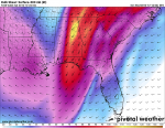
GFS shows potential for total accumulated rainfall of 1.5 inches in south Atl to 2.0 inches in north Atl up to near 3.8 inches in extreme NE Ga. before the system is out of here on Thursday. (two fronts passing through)
The NAM is not as generous shorting those totals by an inch to an inch and a half less.
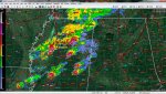
The GFS also indicates the potential for some thunder boomers, mainly in South Central to South Alabama, but with a lesser potential in West Ga from Columbus northward.
The unknown is timing of air masses meeting and intensity.
The positive, we are for sure about to get some rain. The unknown, exactly how much and how strong.
As usual, time will tell.
Tuesday into Wednesday, 29th & 30th
GFS shows potential for total accumulated rainfall of 1.5 inches in south Atl to 2.0 inches in north Atl up to near 3.8 inches in extreme NE Ga. before the system is out of here on Thursday. (two fronts passing through)
The NAM is not as generous shorting those totals by an inch to an inch and a half less.
The GFS also indicates the potential for some thunder boomers, mainly in South Central to South Alabama, but with a lesser potential in West Ga from Columbus northward.
The unknown is timing of air masses meeting and intensity.
The positive, we are for sure about to get some rain. The unknown, exactly how much and how strong.
As usual, time will tell.