DDD
Winter Weatherman
So I wondered with the drought how long it would take before I got to talk about winter weather.
Before we go forward we have to go back. The summer was a blow torch El Nino. One for the record books. Typically strong El Nino's are followed by weak to mild La Nina's. Weak to Mild La Nina's are typically mild on temps and very dry.
Obviously we have been very dry already however the pattern has changed at least temporarily if not permanently. Also, it's winter time. I don't care how you slice it, it's winter and it's about time we had some things to talk about.
Typically January and February are our "winter months". February 14th is always my favorite date to guess as to when we will see a good snow storm. So when I look at winter weather in December I think of it as bonus winter weather. December should be "laying the ground work" for January and February. I feel the same way about March. It's bonus if we have winter weather threats in March.
The CPC (Climate Prediction Center) came out in early November and stated that a weak La Nina is most probable and to expect typical La Nina conditions through the next three months. There is some indicators however data is starting to point to a rapid decreasing of La Nina. In other words, La Nina may only last for a very short time which would give credit to January / February being a more typical winter. Which for the South East is usually wet and mild winter temps with shots of cold mixed in. I personally believe that is where we are headed.
So let's break this into two sections of thought. First is my thought on the short term and Second will be the thought on January / February.
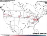
Short Term: I think between now and the first of the year we will have quick, winter "punches". Old Man Winter will throw some cold punches into the South East but because of typical climate, the temps will rebound quickly. Now, typically with cold that spills in from Canada it "pushes" out any moisture. You will hear the Mexican and I refer to it as "Cold chasing moisture". It is possible that the cold air spills in and moisture pours in from the gulf. I will post pictures of that very scenario in a post after this one.
Long Term: The La Nina breaks down, ocean and atmospheric conditions hit more of an anomaly status and perform outside of typical La Nina winters. I think Georgia, South Carolina and North Carolina are tremendously over due for a severe CAD (Cold Air Damming) Event. The way High Pressure has dominated the NE Coast and positioned itself out over the Atlantic I believe one or possibly 2 of those HPS (High Pressure Systems) will "lock in" and with over running moisture an ice storm will take place. I think the potential for ICE this year out weighs the potential for snow. That said though, I think we will see 2-3 real threats of snow for the northern 1/3 of Georgia. I think in the post El Nino and La Nina winter scenario it will be hard for anyone south of Macon to see snow or ice. That's not to say it won't happen, I just think the odds are really low this winter of snow / ice south of Macon.


