Miguel Cervantes
Jedi Master
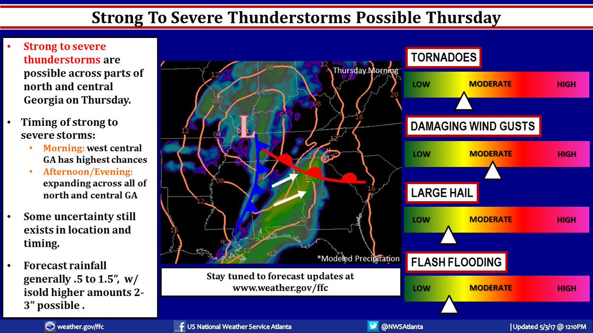
Been putting off posting about this because there is still too much up in the air, but the latest NWS forecast is starting to get on board with what me and others have been watching and concerned about.
#1 - extremely strong cold front moving in Thursday into Friday.
#2 - the propensity for this low pressure to develop a negative tilted trough over the SE keep rearing it's ugly head.
#3 - multiple waves of instability appear likely (at least three)
#4 - the daytime heating. This is still an unknown and will remain so until the day of the event (tomorrow). Should we get significant daytime heating then the Surface Based Cape will elevate into the severe potential zone and we will go from the potential for a scattered strong thunderstorm to the potential for widely scattered severe weather, including high winds, hail, heavy downpours and a moderate chance for tornadoes.
Looking at the 700mb height / vorticity maps it could start as early as 4am in extreme NW GA and continue through several waves through the remainder of the day late into the evening.