***May Severe Weather***

Miguel Cervantes

Jedi Master
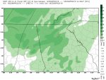
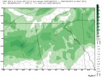
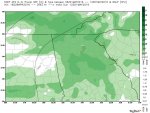
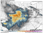
Remember the tropopause event we had a few months ago? Where the jet stream wind flow's dipped well down into the troposhpere? Well it's settin up to happen again around May 7th. Looks like the east coast, even up around NC Hillbilly's hillside will get in on the windy action. For some reason the dates and times didn't come out clear on this gif, but watch for that sudden drop in winds from the NE to the NC region towards the end of the video.

Yes, Blackberry winter is on it's way by the second weekend in May, and it will be a windy one.

06Z-20160426_GFSUS_2pvu_pres.gif
 
Last edited:

Miguel Cervantes

Jedi Master
Texas has been getting hammered, and there's no end in sight for their misery. The ArkLaTex will get in on the game too in the coming days. Thankfully the worst of the severe stays to our west.........for now.

Here's the supercell composite loop

18Z-20160427_GFSUS_con_scp.gif
 

rhbama3

Administrator
Staff member
Great. My one chance to hunt all weekend and that thing is looming out there.
 

DDD

Winter Weatherman
Some folks have been asking about the upcoming weekend with the race being in Talledega and lots of sporting events happening. It looks to be wet mostly on Sunday.

However, I will say that the latest NAM simulated radar does not match up well to what the GFS has been putting out. However the NAM only goes out to 2AM Sunday.

Nothing severe to speak of just wet.
 

Attachments

  • Sat1.jpg
    Sat1.jpg
    85.6 KB · Views: 878
  • Sun1.jpg
    Sun1.jpg
    89 KB · Views: 908
  • Sun2.jpg
    Sun2.jpg
    84.3 KB · Views: 879

Miguel Cervantes

Jedi Master
From COD Meteorology the 06 hi res NAM is up and what originally looked like an afternoon break on Sunday as rain cleared out to the east on the GFS doesn't look so certain anymore. Looks like it's going to be off and on for the next few days.

06Z-20160430_NAM4KMSE_prec_radar.gif


Here's the standard NAM on Pivotal Weather, which may look a little better, but isn't getting down to the mesoscale level of precip like the hi-res is. For this one you have to click on the link and hit play.

http://www.pivotalweather.com/model.php?m=nam&p=refcmp&rh=2016043006&fh=loop&r=us_se&dpdt=


What would I do if I were a NASCAR fan and had all of that money tied up in tickets? Can't tell you for sure, but I'd be inclined to take my chances, but we all know, one good little shower and it's hours before they can start again. We can send a man to the moon and a probe to Mars but we can't make rain tires and windshield wipers for NASCAR. ::ke:
 

Miguel Cervantes

Jedi Master
Folks in furthermost North Ga, especially NW Ga should pay attention late Tuesday night / early Wednesday morning as conditions become favorably unstable in this region and northward to Tennessee, extreme western North Carolina and Kentucky, and westward to North Alabama, Mississippi, ArkLaTex region etc.

The potential for strong storms and even a bounce n' go (my term for quick hard to predict tornado) will be present as a region of instability moves eastward.

The rest of Georgia should primarily see a chance for rain, though not a good soakin, and there could be a thunderstorm or two mixed in with it.

For the states to our West & NW the danger of tornado's and severe strong thunderstorms is good.
 

Attachments

  • sccomp.png
    sccomp.png
    589.4 KB · Views: 753
  • sigtorpar.png
    sigtorpar.png
    466.3 KB · Views: 755

Miguel Cervantes

Jedi Master
Just a quickie for the morning to round out the week.
Also because "Slight" doesn't mean go about your business and ignore the weather. Folks in S. AL & SOWEGA should pay attention.

From NOAA SPC

day2otlk_0600.gif


day2probotlk_0600_any.gif


SPC AC 190600

DAY 2 CONVECTIVE OUTLOOK
NWS STORM PREDICTION CENTER NORMAN OK
0100 AM CDT THU MAY 19 2016

VALID 201200Z - 211200Z

...THERE IS A SLGT RISK OF SVR TSTMS ACROSS PARTS OF THE GULF
COAST/SOUTHEAST STATES...

...THERE IS A MRGL RISK OF SVR TSTMS ACROSS THE GULF COAST/SOUTHEAST
STATES/FL...

...THERE IS A MRGL RISK OF SVR TSTMS ACROSS MT AND THE NORTHERN HIGH
PLAINS...

...THERE IS A MRGL RISK OF SVR TSTMS ACROSS DEEP SOUTH TX...

...SUMMARY...
SEVERE THUNDERSTORMS WILL BE POSSIBLE FRIDAY ACROSS THE CENTRAL GULF
COAST AND SOUTHEAST STATES AS WELL AS THE NORTHERN HIGH PLAINS AND
DEEP SOUTH TEXAS.

...SYNOPSIS...
AN AMPLIFIED LARGE-SCALE PATTERN IS EXPECTED INTO FRIDAY. A LONGWAVE
TROUGH WILL CONTINUE TO DIG SOUTHWARD OVER THE WESTERN STATES...WITH
AN UPPER RIDGE OVER THE NORTHERN/CENTRAL PLAINS...AND AN
EAST/NORTHEASTWARD-MOVING SHORTWAVE TROUGH OVER THE MID-SOUTH/TN
VALLEY TO SOUTHERN APPALACHIANS.

...CENTRAL GULF COAST/TN VALLEY/SOUTHEAST STATES...
A SOUTHERN-STREAM IMPULSE WILL CONTINUE TO SPREAD EAST-NORTHEASTWARD
ACROSS THE REGION ON FRIDAY...WHILE A MARITIME AIR MASS WILL SLOWLY
DEVELOP NORTHWARD ACROSS THE CENTRAL GULF COAST/SOUTHEAST STATES.
SCATTERED THUNDERSTORMS ARE LIKELY TO BE ONGOING FRIDAY MORNING
ACROSS PARTS OF THE CENTRAL GULF COAST STATES/TN VALLEY AND
POTENTIALLY AS FAR EAST AS THE SOUTHERN APPALACHIANS...AND THIS
EARLY-DAY CONVECTION COMPLICATES THE FORECAST DETAILS.

A WEAK SURFACE WAVE...POTENTIALLY ACCOMPANIED BY A MODERATELY STRONG
LOW-LEVEL WIND FIELD /SOME SPATIAL VARIABILITY IN AVAILABLE
GUIDANCE/...SHOULD DEVELOP NORTHEASTWARD ACROSS PARTS OF THE TN
VALLEY TOWARD THE SOUTHERN APPALACHIANS FRIDAY AFTERNOON/NIGHT.
HOWEVER...IT IS CURRENTLY UNCERTAIN IF APPRECIABLE DESTABILIZATION
WILL OCCUR WITH NORTHWARD EXTENT WITHIN A NARROW WARM SECTOR /NEAR
THE SURFACE LOW AND APPALACHIANS-VICINITY WEDGE FRONT/ ACROSS THESE
REGIONS. GIVEN THE POTENTIAL FOR MODERATE DESTABILIZATION IN THE
PRESENCE OF 30-35 KT OF DEEP-LAYER SHEAR...SOUTHERN PORTIONS OF
LA/MS/AL INTO GA/FL WILL HAVE AT LEAST SOME POTENTIAL FOR DAMAGING
THUNDERSTORM WINDS...BUT A SEVERE RISK CANNOT BE RULED OUT AS FAR

NORTH AS THE SURFACE LOW/WEDGE FRONT VICINITY WHERE
LOW-LEVEL/DEEP-LAYER SHEAR WILL BE STRONGER. OTHER
STRONG/POTENTIALLY SEVERE THUNDERSTORMS WILL BE POSSIBLE ACROSS THE
FL PENINSULA WITH AID OF SEA BREEZE CIRCULATIONS.

...MT/NORTHERN HIGH PLAINS...
WHILE SOME EARLY-DAY CONVECTION MAY OCCUR/LINGER...THUNDERSTORMS ARE
EXPECTED TO REDEVELOP/INTENSIFY ACROSS MT FRIDAY AFTERNOON WITHIN A
MODESTLY MOIST BOUNDARY LAYER NEAR A WEAK SURFACE LOW/FRONT.
PORTIONS OF EAST-CENTRAL MT CURRENTLY APPEAR MOST LIKELY TO BE AT
RISK FOR AT LEAST A FEW STORMS WITH HAIL/DAMAGING WIND POTENTIAL
FRIDAY AFTERNOON/EVENING.

FARTHER SOUTH-SOUTHEAST...A SHARPENING LEE TROUGH WILL CONTRIBUTE TO
A GRADUAL INFLUX OF MODEST LOW-LEVEL MOISTURE INTO THE NORTH-CENTRAL
HIGH PLAINS...WITH SURFACE DEWPOINTS POTENTIALLY CLIMBING INTO THE
UPPER 40S/LOWER 50S AS FAR WEST AS EAST/NORTHEAST WY. OVERALL
FORCING/VERTICAL SHEAR WILL NOT BE STRONG /30 KT EFFECTIVE/...BUT A
COUPLE OF STRONGER STORMS CAPABLE OF HAIL/WIND COULD DEVELOP FRIDAY
AFTERNOON/EVENING ACROSS PARTS OF EASTERN WY/FAR WESTERN NEB AND THE
BLACK HILLS VICINITY.

...DEEP SOUTH TX...
WHILE NOT CERTAIN /PARTICULARLY GIVEN CONVECTION OVER PRIOR
DAYS/...AT LEAST A CONDITIONAL-TYPE RISK WILL EXIST FOR A COUPLE OF
SEVERE THUNDERSTORMS WITHIN A WEAKLY FORCED REGIME WITH RISING UPPER
HEIGHTS. WEAK NEAR-BOUNDARY CONVERGENCE AND/OR UPSLOPE FLOW INTO THE
MOUNTAINS OF MEXICO COULD LEAD TO DEEP CONVECTIVE DEVELOPMENT FRIDAY
AFTERNOON/EARLY EVENING. VEERING WINDS WITH HEIGHT AND MODERATE
BUOYANCY COULD SUPPORT SUPERCELLS IF STORMS INDEED FORM.

..GUYER.. 05/19/2016
 

Miguel Cervantes

Jedi Master
Looky what we got here.

NCHillbilly or Hornet 22 must be headin to the coast.

two_atl_5d0.png


ZCZC MIATWOAT ALL
TTAA00 KNHC DDHHMM

SPECIAL TROPICAL WEATHER OUTLOOK
NWS NATIONAL HURRICANE CENTER MIAMI FL
815 AM EDT WED MAY 25 2016

For the North Atlantic...Caribbean Sea and the Gulf of Mexico:

1. An area of cloudiness and showers over the western Atlantic Ocean
northeast of the Bahamas is associated with the interaction of an
upper-level trough and a weakening front. While development is not
anticipated for the next couple of days, environmental conditions
are expected to become more conducive for tropical or subtropical
development on Friday. This area of disturbed weather is forecast to
move slowly west-northwestward or northwestward and gradually
approach the southeastern United States over the weekend. The next
Special Tropical Weather Outlook will be issued by 8 PM EDT tonight.
* Formation chance through 48 hours...low...10 percent
* Formation chance through 5 days...medium...50 percent

Forecaster Blake
 

Miguel Cervantes

Jedi Master
Startin early this year. Hmmmmm.

two_atl_5d0.png


ZCZC MIATWOAT ALL
TTAA00 KNHC DDHHMM

SPECIAL TROPICAL WEATHER OUTLOOK
NWS NATIONAL HURRICANE CENTER MIAMI FL
825 AM EDT THU MAY 26 2016

For the North Atlantic...Caribbean Sea and the Gulf of Mexico:

1. A low pressure area centered between Bermuda and the Bahamas is
gradually becoming better defined while shower activity is
increasing. Environmental conditions are expected to become more
conducive for tropical or subtropical cyclone formation on Friday
while the system moves west-northwestward or northwestward toward
the southeastern United States coast. With the Memorial Day weekend
approaching,

all interests along the southeast coast from Georgia
through North Carolina should monitor the progress of this low.


An Air Force reconnaissance plane will be scheduled to investigate
this low on Friday. The next Special Tropical Weather Outlook on
this disturbance will be issued by 3 PM EDT today. For additional
information on this system, see High Seas Forecasts issued by the
National Weather Service.
* Formation chance through 48 hours...medium...50 percent
* Formation chance through 5 days...high...70 percent

High Seas Forecasts issued by the National Weather Service can be
found under AWIPS Header NFDHSFAT1 and WMO Header FZNT01 KWBC.

Forecaster Avila
 
Top