***October Severe Weather***

Miguel Cervantes

Jedi Master
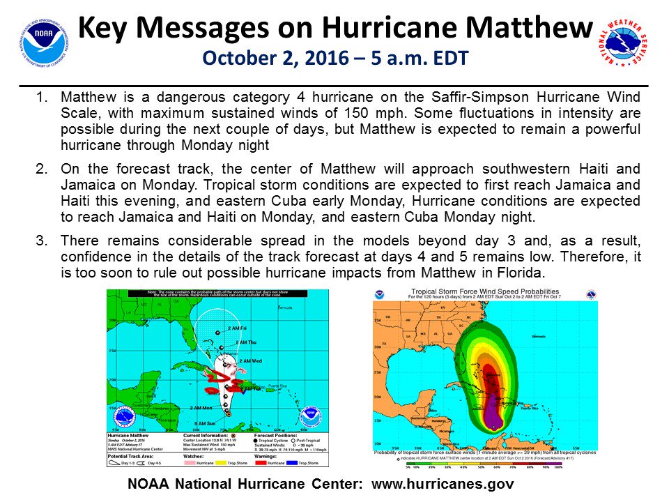
If this proves out the Bahamas will get ripped. I can't remember the NHC using the designation of "M" before. It's a good addition indicating a major hurricane with winds greater than 110mph. Still not sold on this track, with that slightly westward jog through the Bahamas.

233921W5_NL_sm.gif
 

Miguel Cervantes

Jedi Master
Discussion from the NHC:

Late in the period the track model spread remains considerable, as
the global models continue to have issues depicting the synoptic-
scale pattern over the eastern United States and western Atlantic in
4-5 days. The evolution of the mid/upper-level low currently
centered over the Ohio Valley and how it interacts with the western
Atlantic subtropical ridge appear to be critical to the long-term
track of Matthew. The UKMET and ECMWF tracks have shifted westward
and slower by day 5, while the GFS has trended east. This has
narrowed the guidance envelope somewhat, but given the lack of
run-to-run consistency I'd hesitate to say that confidence in the
long-range track forecast has increased by any appreciable measure.
The new NHC track at these times leans heavily on continuity, and by
day 5 is close to the GFS/ECMWF blend and left of the latest
multi-model consensus aid TVCN.

It is important to remind users that average NHC track forecast
errors are around 175 miles at day 4 and 230 miles at day 5.
Therefore, it is too soon to rule out possible hurricane impacts
from Matthew in Florida.
 

DDD

Winter Weatherman
So with every model run this thing gets closer and closer to the Florida Coast. One thing is for sure the models have come back West the more data that has gotten pumped in about the strength of the trough in the Atlantic that will push this thing back West.

The other problem is the strength of Matthew, the winds, the waves and the rain are just going to be crazy. Right now he is cranking out 140MPH sustained winds with gust up to 160MPH.

A worst case scenario is that he slides over to the Florida coast and just rides the coast until he goes in around Charleston or Myrtle Beach or continues up the coast. At that point, as modeled he would be a Category 3 the whole way.

There are not a lot of analogs to compare this on to. It's coming from a weird place and the strength is just insane.

If the eye of the storm got right on the Florida Coast and rode north I would be worried about a Savannah landfall but the waves and wind would be shoving so directly into the coast, it would not matter where the eye was at that point it would be a big deal for the Georgia Coast.

If you have plans along the coast this weekend you need to pay very close attention over the next 48 hours and possibly re-think it.

As for inland GA we will be on the west side of the storm and typically we will be high and dry.
 

Attachments

  • Matt_1.gif
    Matt_1.gif
    45.4 KB · Views: 932

Miguel Cervantes

Jedi Master
Matthew now coming into range of US radar. Folks in Palm Beach area of FL will see conditions deteriorate through the day.

WUNIDS_map


at201614_radar.gif


Tracks of all October Tropical Systems. As you can see there are no comparative tracks to the one forecast for Matthew.

at201614_climo.gif
 

Miguel Cervantes

Jedi Master
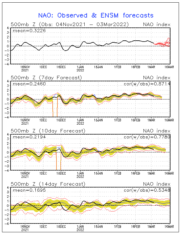
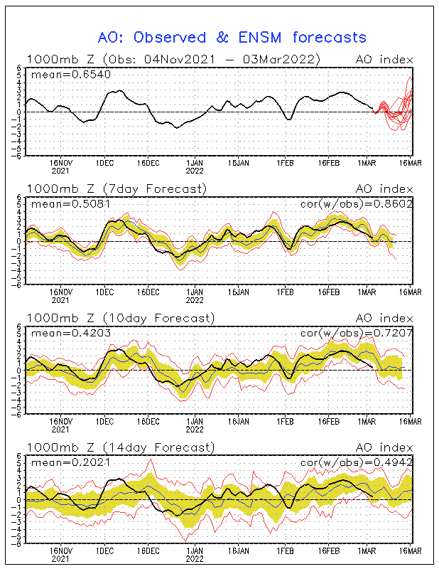
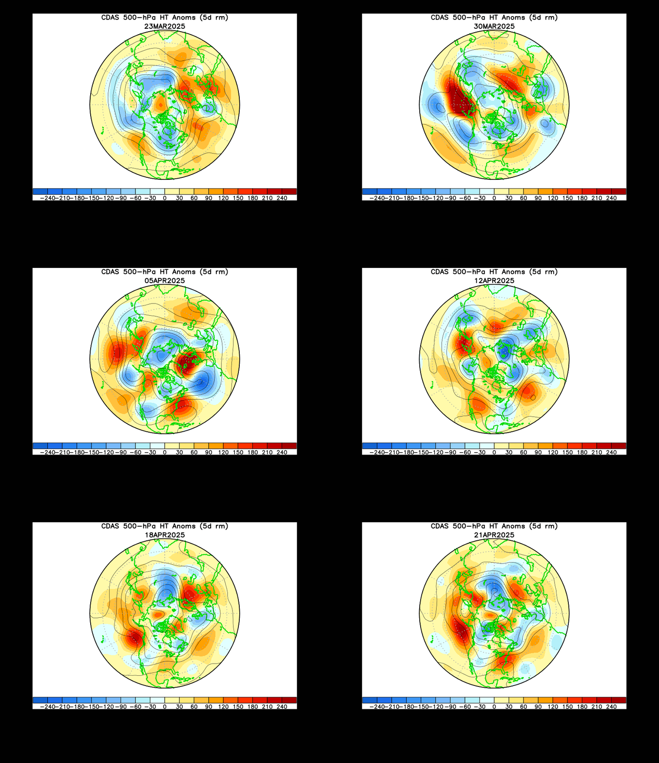
On a positive note and looking forward to mid month, the North Atlantic Oscillation is forecast to go seriously negative. This is extremely good news for getting DDD off his butt and back in the Winter Weather Forecast game. Same goes for the Arctic Oscilation. The last graphic shows the cooler air getting bottled up in the south. :cool:

nao.sprd2.gif


ao.sprd2.gif


z500_nh_30d_anim.gif
 

Latest posts

Top