Lake Lanier History Photos

natureman

Senior Member
So, I recently came across over 700 construction photo of Lake Lanier and Buford Dam. I posted them with narrative over on a Facebook group which I can't / shouldn't post a link to because of bad language. It was in multiple parts. I thought I would see if there was any interest here.

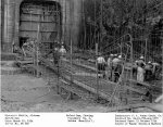
Part I. Some historic photos of Lake Lanier construction. Here is a series of the forebay/water intake structure for the Powerhouse. Just the top part is visible today.
221831951_2857470367849443_5747304178491884125_n.jpg
BU 266 Forebay.jpg
bu-333-intake-jpg.1094894
BU 368 Intake.jpg
 

Attachments

  • BU 333 Intake.jpg
    BU 333 Intake.jpg
    976.5 KB · Views: 1,420
Last edited:

natureman

Senior Member
Part II. Buford Dam is actually composed of several structures. Of course there is the main dam that spans the Chattahoochee River channel. But there are 4 other structures called “saddle dikes” which enable the lake to rise up to its maximum flood level of 1085 msl. The majority of the saddle dikes are the twisty road you drive from Sawnee Campground east past West Bank Park. They were completed early on in the construction process. Here are some photos as well as a recent aerial showing their location. I will post about the main Dam construction later since it is more complex and there are lots of photos.
224506532_2857783037818176_5223876191302594011_n.jpg
223083874_2857783077818172_7349211057504395562_n.jpg
224938909_2857783017818178_8512253125571474915_n.jpg
219169791_2857782951151518_7092899420178617088_n.jpg
 

natureman

Senior Member
Part III. The emergency spillway is located in the boat ramp parking lot at Lanier Park. It is simply a blasted and leveled cut through a hillside at elevation 1085 msl. Should the lake ever get to that level, which is way above full 1071 msl, the lake water would freely flow through the cut, then across Buford Dam Road, and follow a ravine to Richland Creek with flows into the Chattahoochee downstream of the dam. It is a simple feature relying on gravity flow. I have included an aerial photo that shows its approximate path. The COE has flowage easements along the way to keep homes from being built in it. The spillway has never been used but one day it might and in theory could prevent the saddle dikes and main dam from failing. There is a much more efficient and controlled way of releasing large volumes of water from the lake via the emergency sluice and turbines located at the Powerhouse. I will save that discussion for later.
226206822_2858117744451372_5742992195192683702_n.jpg
224847900_2858117827784697_5609369242512453298_n.jpg
223604601_2858117807784699_6204548074445476730_n.jpg
226275900_2858117844451362_2072978810824130818_n.jpg
225382769_2858117764451370_4016967405898129278_n.jpg
 

natureman

Senior Member
No. I curated all the land acquisition records for the COE at Lanier which includes photos of buildings in the lake's footprint. I saw no towns. Just rural farmland. You can go to this site and search the land purchase records for Lanier which include building photos. TRACT SEARCH | lakelanierhistory
 

Artfuldodger

Senior Member
Are those Saddle Dikes to fill in the low areas between the hills? I don't think I've ever seen that concept used in lake construction. Usually they just let the water back up to wherever it backs up.

The spillway concept is interesting. I don't think I've ever seen one of those around Georgia either on a like of that size. It does seem like a good idea. Those housing developments are really close to Richland Creek.
 
Last edited:

natureman

Senior Member
Yes by building the saddle dikes it increased the size of the lake. Near the spillway is a deep ravine between the subdivisions but I think Gwinnett Co. dropped the ball allowing them to be built there. They should have established a buffer zone.
 
Last edited:

mguthrie

**# 1 Fan**OHIO STATE**
Yea, a lot folks toured Buford Dam as kids. Since 9/11 Buford Powerhouse has been locked down under Army security regulations.
I used to trout fish there a lot in the late 80’s and you could just walk in and tour it. They did have viewing areas you had to stay confined to but you could see the turbines in action
 

natureman

Senior Member
Yes, there wasn't any need to remove the track and concrete bleachers since they would not be a navigation hazard.
 

natureman

Senior Member
Part IV. Buford Dam spans the Chattahoochee River between two hillsides. To construct it the COE had to reroute the river and excavate down to bedrock before the dam could be built. This type dam has a lateral core of compacted impervious material (clay) which is flanked by other material and rip-rap stone on the lakeside to hinder erosion. I couldn’t find an a diagram to further illustrate this. Here is something most of you all are not aware of “most earthen dams leak”. Buford Dam is no different. It depends on the mass of the material and the impervious core to retain its structural integrity. Nevertheless water manages to seep through and the COE has monitoring devices to determine where, how much and knows when there might be concern. Inspection is on a frequent basis and a special team of engineers periodically inspect the dam for condition and to prioritize repair work. The dam and the saddle dikes don’t just maintain themselves and a lot of work goes into inspection, mowing, erosion repair and determining if it has shifted. Shifted you say, well the dam is built on the supposedly inactive Brevard Fault Line. All this work goes on pretty much unnoticed by the public.
https://en.wikipedia.org/wiki/Brevard_Fault
221557779_2858455537750926_9065653043645928695_n.jpg
 
Top