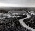
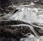
Lake Lanier History Photos

Buford_Dawg

Senior Member
My wife's family are all Buford originals. I have listened many a evening sitting on the porch with her grandfather about the lake and damming it up, etc.... He got to watch every bit of it. Very interesting conversation, he left us about 10 years ago at age 97. He hunted all the land around buford dam, along Hwy 20 on both sides of the river, said they mostly rabbit and squirrel hunted back in those days, not many deer around. I miss his story telling. He had several books telling the story of the dam building and lake lanier as it was built out, I assume my MIL has them now.
 

natureman

Senior Member
It was truly a different place back then. Almost all the land bought for the lake was about as rural as you could get. It is difficult to relate to compared to development around the lake today. The COE bought about 56,000 acres on average $30 per acre. This involved about 700 individual properties. I made this video about 25 years ago which goes into more detail.
Lake Lanier Construction - YouTube
 

Doboy Dawg

Senior Member
Part IV. Buford Dam spans the Chattahoochee River between two hillsides. To construct it the COE had to reroute the river and excavate down to bedrock before the dam could be built. This type dam has a lateral core of compacted impervious material (clay) which is flanked by other material and rip-rap stone on the lakeside to hinder erosion. I couldn’t find an a diagram to further illustrate this. Here is something most of you all are not aware of “most earthen dams leak”. Buford Dam is no different. It depends on the mass of the material and the impervious core to retain its structural integrity. Nevertheless water manages to seep through and the COE has monitoring devices to determine where, how much and knows when there might be concern. Inspection is on a frequent basis and a special team of engineers periodically inspect the dam for condition and to prioritize repair work. The dam and the saddle dikes don’t just maintain themselves and a lot of work goes into inspection, mowing, erosion repair and determining if it has shifted. Shifted you say, well the dam is built on the supposedly inactive Brevard Fault Line. All this work goes on pretty much unnoticed by the public.
https://en.wikipedia.org/wiki/Brevard_Fault
221557779_2858455537750926_9065653043645928695_n.jpg
The engineer that gave me a tour of Sinclair dam, back in the 80’s, explained in detail how that dam was built in pretty much the same way as this dam.

When he told me about how much the dam was allowed to move, I was surprised. He explained how it had to be able to flex.

I asked him what all the 2-1/2” looking size holes in the foundation were. He said they have to take core samples every so often. I was amazed at the amount of water that trickles through, with actual stalactites and stalagmites growing inside. I was able to get a few of them, he said those are over 50 years old.

My grandfather was a Lineman. He worked on many of these projects from the TVA all the way down to Key West. He was on the crew that put the power lines from South Florida to Key West. I have pictures somewhere of him working with crews building the first giant steel towers used in Florida when they started crossing all the big lakes. It’s amazing what those linemen built with Model T trucks and jib poles.
 

Jeff C.

Chief Grass Master
(y)
 

natureman

Senior Member
Part V. The penstocks are the pipes thru which lake water travels to the Powerhouse where it turns the turbines and is discharged back into the river. There are two penstock pipes that go to 3 turbines. Their maximum flow is 12,000 cubic feet per second (cfs). The sluice is its own entity and is a straight shot that bypasses the turbines. It is normally used for emergency drawdown of the lake beyond what the penstocks can release. It is capable of discharging 10,650cfs and the flow amount can be regulated. Together (penstocks and sluice) the maximum flow is 22,650cfs. By comparison the normal river flow during the summer is about 750 cfs so at maximum outflow of 22,650cfs there will be some downstream flooding as the river rises out of its banks. In these photos keep in mind that the Powerhouse has yet to be built.
I remember a rare occasion when the sluice was opened I believe all the way. The water came out with such force that it shot up into the air about 50 feet. Focusing on it was both mesmerizing and disorienting.
222903485_2858976554365491_4202894975506906511_n.jpg
222779849_2858976874365459_8043504184930627641_n.jpg
225535014_2858976744365472_1426330622859018833_n.jpg
224592607_2858976604365486_404190515008868684_n.jpg
223629173_2858976417698838_2007483887573299481_n.jpg

223063329_2858976831032130_1964564350414882047_n.jpg
222903485_2858976554365491_4202894975506906511_n.jpg
 

natureman

Senior Member
Part VI. The Buford Powerhouse contains the equipment that produces electricity, distributes it and controls the flow of water from the lake back into the river. In simplistic terms as the water goes thru the penstocks it hits and turns turbine blades sitting beneath generators which produce electricity. Here is a simple explanation https://www.youtube.com/watch?v=Lx6UfiEU3Q0
The Buford Powerhouse uses Francis design turbines whose origin goes back to the late 1800s. Wikipedia does a good job describing them. The original turbines and control mechanisms installed in the Buford Powerhouse (1950s) have received several upgrades over the years making them more efficient energy producers. Feel how you may about hydroelectric produced power just remember that water released from Lanier will go thru over a dozen hydro-plants as it works its way to the Gulf of Mexico, each producing power. Compare that to burning fossil fuels which is a one and done deal.

Walking thru the Powerhouse during generation periods is a unique experience. You can feel a powerful force moving under your feet and the building which is thick concrete and steel vibrates. It is also pretty noisy. Little known fact is that a portion of the lower level was designed as a fallout shelter. It has since been deactivated.

I will add that the public is not really aware of the folks that work in the Powerhouse. The mechanics and electricians keep the place working and it is spotless. They are a pretty interesting group of people with highly specialized skill sets. I was fortunate to get to know a couple of them fairly well.


225602946_2859222641007549_829641783256107320_n.jpg


225939470_2859222697674210_4652089796848659910_n.jpg


225636737_2859223087674171_3830109475616108009_n.jpg


178544343_2859222977674182_5385538134843035409_n.jpg
225879378_2859223164340830_6622676908606860779_n.jpg
 

elfiii

Admin
Staff member
Where's the Lady in the Lake? :biggrin2:
 

Unicoidawg

Moderator
Staff member
Great thread with awesome pics.

Made this one a "Sticky" to keep it at the top.
 

Geffellz18

Senior Member
Thanks @natureman for sharing! Great thread.
The bridges came down this year and last, sadly enough. They about have Browns bridge completely dismantled now.
I’m guessing the second to last bridge pic was the one spanning 129 above the Chatahoochee channel north of Gainesville. It was replaced a year or two back now if so.
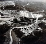
So neat to see construction photos of them being built, and experiencing them coming to their end of service!
I’ll miss those iconic green steel bridges!
 

JonathanG2013

Senior Member
No. I curated all the land acquisition records for the COE at Lanier which includes photos of buildings in the lake's footprint. I saw no towns. Just rural farmland. You can go to this site and search the land purchase records for Lanier which include building photos. TRACT SEARCH | lakelanierhistory


Morning. There was an episode of Expedition X where they scuba dived and found grave stones buried under the lake which is interesting.
 
Top