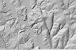
I do, and I know a lot of you guys also utilize online mapping for scouting purposes. There's a lot of tools out there beyond your basic satellite imagery, but one I'm wanting to look into is LIDAR. Anybody got any experience with LIDAR mapping?
Yes, I've used the shade relief feature on caltopo. I guess I've always been able to "see" topo maps pretty well without aid, but it's a nice feature. I really want to use lidar to find old logging roads and see where they lead. I'm not finding lidar layers for here though. Hoping someone knows more than me.LIDAR is very neat. Check out caltopo.com If you haven’t already. You can use multiple map layers at once and set the percentage of each separate layer to create really useful views. There is layer called shade relief, which I believe is, or is similar to LIDAR. It gives three options, but only one works for me which is the “normal” option (computer issue?? Idk). It shows amazing detail. I personally like to used the satellite imagery with the shade relief over top of it.
View attachment 1060479View attachment 1060480Here’s an example of one that I found. I like reading Topos, but I definitely get more out of the shade relief. So I guess I’ve never used LIDAR then. I’m curious to hear about it as well.
Sure. Im just using the “normal” shade relief. The other two options have never work for me(??). Now a problem I have noticed is that sometimes the map will have an area that will not completely load all of the detail. When you are zoomed out it looks like the map is loaded, but you zoom in and there’s some detail there, but nothing like it should be. I’m not sure why this happens and it can be very frustrating. So maybe try zooming out to check another area to make sure that’s not happening ing to you. I typically use an imaginary layer, the forest service topo layers because it will show trails, and the shade relief. That can all be done on the left side of your screen.Ok, that's what I'm talking about. I've toyed around with custom relief shading and gotten similar results to that, but not that well defined. Care to share what settings you're using to see that?
The LIDAR cuts right through the vegetation and crap and shows you what's there.
I've toyed around on the Caltopo page and you can manipulate the shade angles and azimuth of light and I can spot roads that I know are there but don't show up on satellite imagery.
It's the roads I'm not familiar with that I want to explore. Old abandoned logging roads that I've come across and wondered where they go and where they started. Might save some walking time in the dark if I can find a road that gets me near where I want to be. Or make it easier on the pack out.