onX hunt for finding property lines

turkeykirk

Senior Member
I have the on X hunt app and was thinking about using it to find and post some property lines. This land has been in my wife’s family for years and I was constantly telling my late father in law the property line was over further than he thought it was. (According to the on X app). Going to get a boat and cross the creek to get access . Wonder how close I might be to getting it right if I use the app. Thanks.

 

NCHillbilly

Administrator
Staff member
I have the on X hunt app and was thinking about using it to find and post some property lines. This land has been in my wife’s family for years and I was constantly telling my late father in law the property line was over further than he thought it was. (According to the on X app). Going to get a boat and cross the creek to get access . Wonder how close I might be to getting it right if I use the app. Thanks.
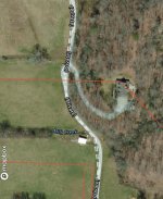
It will get you fairly close, but probably not legal close. You can usually find corner stobs with it. There's a reason that I have to have a $10k Trimble GPS unit to do accurate GPS stuff at work, and I still have to post-process the data with GPS Pathfinder Office software to create reliable sub-meter accurate GIS feature classes.
 

1eyefishing

...just joking, seriously.
Yeah, you can find out how accurate by walking any trail with your tracker on and then walk it back. Walk a quarter or a half mile or more and then compare the tracks back and forth.
The 2 tracks being 25 feet or more apart on your screen will show you how accurate it is....
 

kayaksteve

Senior Member
It’s fairly close on most of our lines but there’s an area it’s well over 100ft off on ours. Ours was surveyed a couple of years ago and we lost a little in places and gained some in places based off where I’ve always understood to be the line.
 

NCMTNHunter

Senior Member
In my experience the gps on a phone is only accurate to with 40 or 50 feet. And onx doesn’t know where your property lines are. It just pulls from your counties tax data which is about the same as far as accuracy goes. That being said you can use onx to find property line or corners if there are any old markings to find on the ground. You can’t use onx alone to start nailing no trespassing signs to trees.
 

NCMTNHunter

Senior Member
Here is an example of what I’m talking about. This is my father in laws place. It shows the property corner being right on his house when all the property lines in area should be shifted up to align them with the two grown up fence lines in the field.

IMG_4005.jpeg
 

Dustin Pate

Administrator
Staff member
They get their information from whoever is responsible for GIS work for your county. I'm very familiar with that part of it (that's my job) and I do not trust any of the online services. They will get you in the ball park...usually. Your best bet is a recorded survey and set pins.
 

Gator89

Senior Member
Most counties now have link to properties on a public website, often the property appraiser and access is free.

One day while I was sitting in my stand I pulled up the Calhoun County website and could see property owners and property lines

But for folks that travel and use the maps frequently an app can be a handy tool.
 

cowhornedspike

Senior Member
If you have a survey with measurements and can find a known starting point then you can easily draw your property lines on google earth with decent accuracy.
 

killerv

Senior Member
nope, already ran off a guy who tried to make an argument using it. Joker put a feeder on my property and everything. He was about 100 yards over.

The qpublic plot lines in google earth are dang close if you have decent signal.
 

Madsnooker

Senior Member
The free version of ONX is close but not reliable. The paid version is very accurate but not everytime. As said earlier, land glide app is excellent. My son has a land management business and he works with surveyors all the time and he said land glide is very accurate most of the time. We bought a small piece of property recently in ga and used his land glide app on his phone when we first walked it thru a swamp. We found both back corner markers exactly where the app showed and when the official survey was done for the bank it matched exactly with what land glide showed.
 

bfriendly

Bigfoot friendly
I use it on the HuntStand app and the lines are accurately drawn(tax assessors records), but the location or placement of my location is always moving while I’m standing still. If something isn’t recorded it won’t show up either. My buds place in Taylorsville was an example of that. The app showed 8 acres clearly, but it was only 5 and the plat he had Was different. If you get close, usually you can find landmarks on the ground like concrete or metal posts etc…
 

westcobbdog

Senior Member
Don't really use much technology when I hunt as I already know the lines hunting mostly WMA's or timber co land, but I do know as a long time real estate agent all the software out there showing property lines is not 100% accurate, from diff apps to qpublic.net or the local county GIS plus all the real estate related software I use like Ga mls and FMLS. I see insccuracies all the time. Just saying..
 

Deernut3

Senior Member
Nearest I can figure my ON X will get me some where around 6 ft of known corners or lines. If you stand over a corner post it will hover around a bit. Definitely not pinpoint accurate but close enough to figure it out. I would not use it to mark or post unknown property boundaries.
 

NCHillbilly

Administrator
Staff member
Here is an example of what I’m talking about. This is my father in laws place. It shows the property corner being right on his house when all the property lines in area should be shifted up to align them with the two grown up fence lines in the field.

View attachment 1287211
That looks like a datum/projection issue on the map-using gis/gps data with a base layer from a different coordinate system or datum than it was originally created in without doing a projection transformation has that exact effect-the data stays in relative position to itself, but is all off the same amount on the base layer. For example, data that was created in a State Plane system being projected in UTM, or NAD 27 datum used in NAD 83.
 
Top