StriperrHunterr
Senior Member
I can pee more than we'll get the next couple of days.
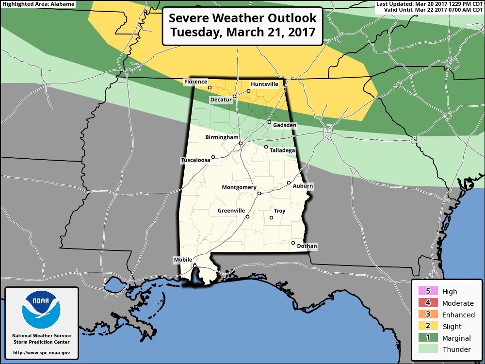
Something on this link y'all may want to read and keep in the back of your mind for the next few weeks to come.
https://www.wunderground.com/blog/JeffMasters/tornado-risk-amping-up-this-week-and-beyond
Ummm, okay.
I'm trying to get out feeshing Saturday. I can handle rain, but not lightning. I hope it misses us.